Home Life Earth Air Fire Water
Celebrating Rivers
CONTENTS
rivers ~ creeks ~ billabongs ~ rapids ~ gullies ~ brooks ~ waterfalls ~ islands ~ eddies ~ waterways ~ The Overflow ~ bournes ~ cascades ~ streams ~ meanders ~ rivulets ~ whirlpools ~ cataracts ~ chutes
|
About Rivers
The simplified version... see hydrology or geomorphology texts for the full version!
- Rivers drain drainage basins. The surface of the basin is the river's catchment area. The soil and rock in the catchment acts as a sponge, soaking up most of the rainwater which falls on it. The water held in the soil is called the groundwater. The watertable is the zone between saturated and unsaturated soil. Springs form where this watertable is exposed on the surface of a hillside.
- A river is a body of water flowing in a channel. The water comes from runoff across the land soon after rain, from springs, and as groundwater outflow from the river banks. The amount of water in the channel at any one time is called stream flow and is made up of base flow supplied by the groundwater and flood flow, the pulse of water supplied after rain in the catchment. Flood flow is normal in areas where there is a seasonal variation in rainfall: it only becomes a problem to humans where the river breaks its banks and water flows into human settlements.
- Flowing water, in rivers or across the land, is the main agent of change in the landform. The water flows downhill under the influence of gravity but the speed of the water flow is also influenced by the shape and roughness of the channel surface and the amount of turbulence in the water.
- Floods increase the volume and speed of the river and can scour new channels or change the gradient of existing ones. Sometimes the floods will deposit material in the channel and on the banlks to form levees and raise the river above the floodplain. The lower land on the floodplain becomes saturated and forms a backswamp.
- There are no straight channels in nature, rivers are constantly eroding and depositing sediment and tend to form meanders. However, if the underlying rock is faulted or has softer layers, the river will follow the path of least resistance and may form a relatively straight channel. Meandering rivers form a series of bends with shallower riffles on the reaches between them. The bends are the site of local erosion and deposition. The water flows faster on the outside of the bend and erodes steep banks or cliffs. Point bars build on the inside of the bend where the water is slow enough to deposit sediment.
- Braided rivers occur where the flow is very variable over time and the river banks easily erodable. They are common in the semi-arid regions of Australia where rainfall is intermittent and baseflow very small. Braided rivers are a network of channels around islands. They form when the river can no longer carry all the sediment load during flood flow, so it deposits sand and gravel in a midstream island. After the flood, the water level drops and the island is exposed. If there is enough time between floods, the island will be stabilised by vegetation. The two channels either side of the island will develop islands in turn and the pattern is repeated.
- Rivers cut down into their valley if the gradient is changed. They also gradually migrate across their floodplains.
Rivers: Contents
Oz Rivers
The continent is divided into 12 drainage divisions: Gulf of Carpentaria, Northeast Coast, Southeast Coast, Tasmanian, South Australian Gulf, Murray-Darling, Bulloo-Bancannia, Lake Eyre, Western Plateau, Southwest Coast, Indian Ocean and Timor Sea Drainage Divisions.
Australia is the driest continent, so rivers are precious. The low rainfall over most of the continent means that rivers are often dry. Water is extracted from the groundwater stored in the Great Artesian Basin in these areas. Rivers in the northern tropics have large flood flows during the wet season but little flow for the rest of the year. The Great Dividing Range forms the catchment boundary parallel and close to the coast for permanent rivers in the east coast drainage divisions.
1. EastCoast Drainage basins
Brisbane River
The Brisbane River drainage basin of the northeast drainage division is my bioregion. The river drains a basin about 200km long by 100km wide. The catchment is formed by the Great Divide on the west and the D'Aguilar Range on the east. The river flows around the end of the D'Aguilar range before heading north again into Moreton Bay and the Pacfic Ocean. It has four main branches: the Upper Brisbane, Stanley, and Bremer Rivers and Lockyer Creek. There are 7 dams built in the catchment, the largest being Lake Wivenhoe on the main channel. The river is tidal up to 90km upstream.
Brisbane City is on the lower reaches of the river which meanders through the central city as well as the suburbs. The river defines inner city layout and is widely used for transport and recreation. Although the banks are heavily modified with walls and road construction, mangroves are gradually recolonising the waterline.
Brisbane River photos are by Chani Martin
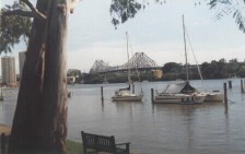
The Merrivale Bridge, only completed in 1978, connects northside and southside rail systems. The river has physically and socially divided the population into northsiders and southsiders.
|
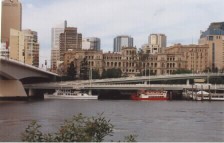
City Reach, showing the Monolith, a building which worries us. It houses all sorts of weirdos who are no doubt 'up to no good', like Microsoft and Senators. |
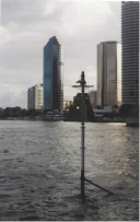
Victoria Bridge & Riverside Expressway (Captain Cook Bridge). The expressway is a barrier between the river and the western side of the CBD. We loved cars, not the river, in the seventies. |
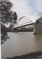
Story Bridge and City Reach. The Bridge, opened in 1940, is built from the cut bank to the point bar and ridge of Kangaroo Point. In summer, yachts shelter here from cyclones on the Great Barrier Reef. |
Snowy River
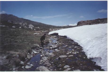
The Snowy River close to its source near Mt Koscuiosco, the highest point in Australia. The last remaining snow in midsummer is still melting to create the river. The river is heavily modified by the Snowy Mountains Hydro Scheme further downstream
|
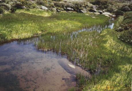
The Snowy River runs through boggy areas and fields of wildflowers in summer.
|
2. Murray - Darling Basin
The Murray-Darling is the fourth longest river in the world (5,251km). It has a drainage basin of 1,072,260 sq. km which drains much of southern Queensland, New South Wales, northern Victoria and South Australia.
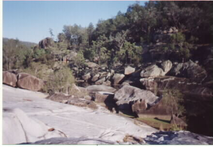
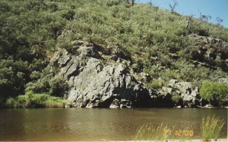
The Severin River, near Ashford in Northern New South Wales. The river runs through a gorge of granite boulders at this point, just above its confluence with the McIntyre River. The McIntyre and Severin Rivers flow to the Dumaresq River and are part of the Murray-Darling Basin
|
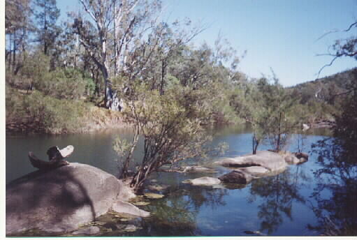
The McIntyre River, near Ashford in Northern New South Wales. This tranquil stretch is just above the McIntyre Falls.
|
The Paroo River at Eulo, in South West Queensland. A great campsite, on the way to the Yowah opal fields. The Paroo is part of the Murray-Darling Basin.
|
The Murrumbidgee River at Bredbo, in New South Wales. The river flow in these upper reaches is regulated by the Snowy Mountains Hydro scheme. It is used for irrigation further downstream. The Murrumbidgee eventually flows into the Murray River.
|
3. Lake Eyre Basin
Lake Eyre drainage basin rivers flow into Lake Eyre in South Australia, not the sea. Most of the rivers are intermittent, dry most of the time. When they are in flood, vast inland lakes form. The Channel Country in south-west Qld is part of this semi-desert landscape.
The Diamantina River in Central Western Queensland has a braided channel. It flows into the Cooper Creek and from there to Lake Eyre. |
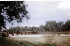
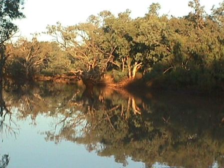
Cooper Creek, near Windorah, in South West Queensland. This bridge is over the main channel, but is surrounded by many minor channels and islands. The channels are mostly dry but fill every few years. Cooper Creek is part of the Lake Eyre drainage basin.
|
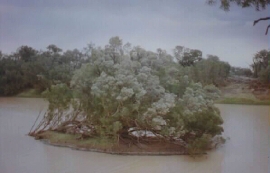
An island in the main channel of Cooper Creek.
|
Rivers: Contents
Links to other sites on Rivers
International Rivers Network
(Australian) Land and Water Resources Research and Development Corporation
Home Life Earth Air Fire Water